
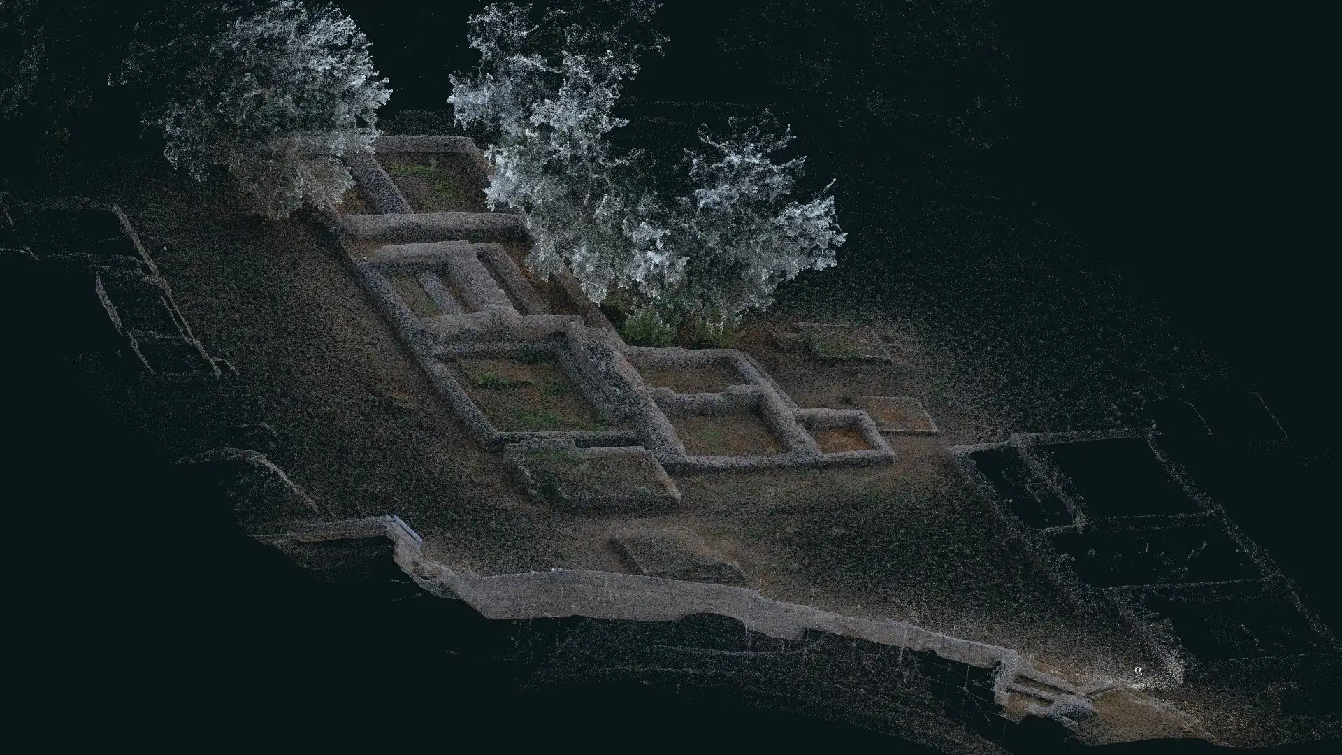
Mapalytics provides LiDAR scanning and SLAM mobile mapping across Pakistan, from Islamabad and Rawalpindi to Lahore, Karachi and Peshawar. Our surveyor walks the site with a handheld LiDAR scanner. It records millions of measured points as it moves, and SLAM software turns the walk into one accurate, colourised point cloud.
A LiDAR survey done this way is the fastest way to measure what is actually on the ground: a multi-storey building, a factory, an archaeological site or a kilometre of road, often captured in a single visit.
What we map with LiDAR SLAM
- Buildings and interiors. As-built floor plans, sections and scan-to-BIM models for renovation, fit-out and facility management, including basements and plant rooms.
- Construction sites. Regular scans to record progress, check work against the design and measure earthworks and stockpiles. See also construction monitoring.
- Heritage and archaeological sites. Detailed, permanent records of ruins and monuments, building on our work at the Makli Necropolis with UNESCO.
- Industrial plants. Pipe racks, equipment and structures mapped for inspection, clash checks and retrofit design.
- Roads, streets and trails. LiDAR surveys of corridors, captured from the ground for design, utilities and asset records, including where trees or buildings block a drone’s view.
- Parks and landscape. Terrain under tree cover, tree positions and heights, and paths for planning and management.
How a LiDAR scanning project works
- Scope. We agree the area, accuracy, deliverables and the software your team uses.
- Walk-through capture. Our surveyor scans the site on foot, and ties it to your coordinates with GNSS control where needed.
- Processing. The SLAM data is processed into a clean, registered point cloud and checked for accuracy.
- Modelling. We produce the drawings, BIM model, volumes or mesh you need.
- Delivery. You receive the files, plus a web viewer so everyone on the project can explore and measure the data.
Need millimetre-level detail for scan-to-BIM? See our 3D laser scanning service, and our drone surveys for large open sites. Working in Saudi Arabia? We offer LiDAR SLAM mobile mapping in Riyadh.

